ARC Field Agent
Digitally collect archaeological data related to units, artifacts, soils, and more in an easily accessible format for analyzing, reporting, and archiving
My Story
ARC (Archaeological Resource Collector) Field Agent was created to revolutionize archaeological data collection, management, and analysis. Designed for efficiency, the application enables digital documentation of units, artifacts, soils, and more—ensuring seamless analysis, reporting, and archiving.
The idea for ARC Field Agent was born from firsthand experience with the challenges of traditional data collection in both academic archaeology and cultural resource management. While working as an archaeological supervisor for a firm in New Hampshire, I encountered significant inefficiencies that slowed down fieldwork and data interpretation. I knew there had to be a better way.
Driven by the need for accuracy, accessibility, and streamlined workflows, I developed ARC Field Agent to modernize data collection and enhance archaeological research. With this tool, professionals can focus less on paperwork and more on uncovering the past.
A Day in the Field

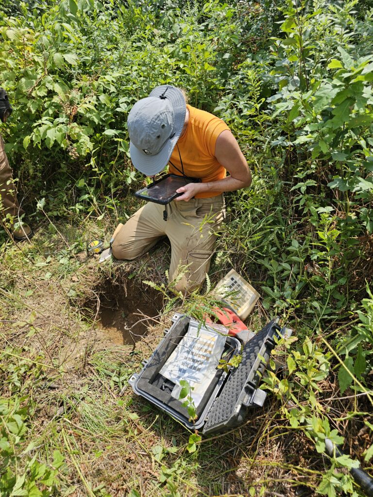
An Independent Archaeological Consulting employee recording a shovel test pit (STP) using the ARC Field Agent software

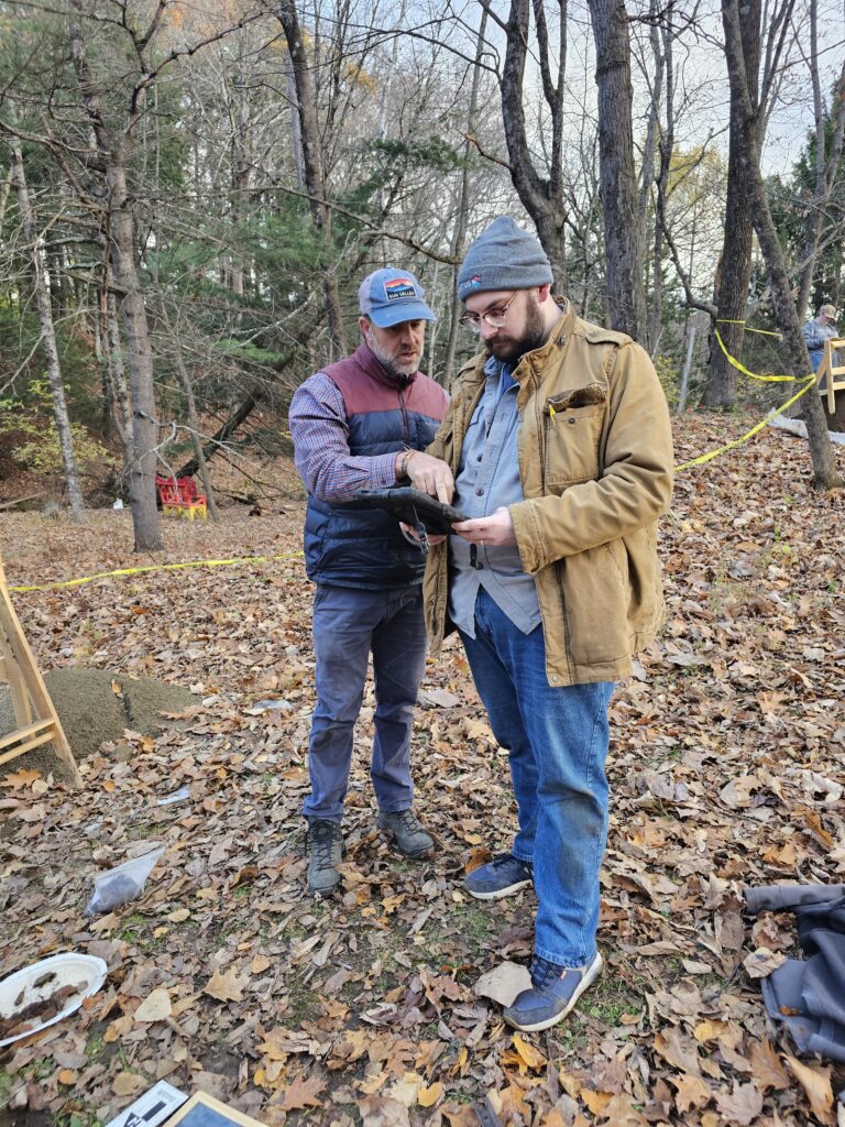
The University of Maine at Farmington fall field school excavation of the Abbott School using the ARC Field Agent software
KEY TOOLS
Profile Reports
Generate profile reports using unit attributes, soils descriptions, and graphics
Project Reports
Generate reports using analytics based on project data and attributes
Unit Profiles
Record slope, soils, and other key details while also visually representing the unit’s profiles
Unit Plan Views
Record slope, soils, and other key details while also visually representing the unit’s plan views
Coordinates
Collect spatial data by recording easting, northing, elevation, and other essential measurements
Artifacts
Record artifact and ecofact data, including location, typology, and other key attributes
Graph Paper
Create sketches and maps with an integrated graph paper tool, including scale and orientation
Munsells
Digital Munsell color handbook for quick reference and visual guidance
Maps
Collect and visualize spatial info over topographic maps, terrain models, and other spatial layers
Daily Logs
Record daily log notes, site conditions, and more
Camera
Capture photos along with key attributes such as direction, photographer, and additional details
Features
Record distinct natural, cultural boundary characteristics, and other valuable attributes
KEY FEATURES
Autofill
Autofill key fields using prior records
Template
Populate a template of key information for input fields
Import and Export
Easily import and export records from multiple devices and formats
Create
Easily create records with proper requirements and relationships
Update
Easily update any record or graphic within any tool
Delete
Delete single or bulk records within a tool or project
Who I Am
Anthony J. Viola is a graduate of the Muskie School of Public Service at the University of Southern Maine, where he earned a B.A. in Geography-Anthropology, with a Minor in Archaeology and a Certificate in Applied Geographic Information Systems (GIS).
Following graduation, he worked as an Archaeological Supervisor and GIS Specialist at Independent Archaeological Consulting before successfully launching Arcudigm, a multifaceted geospatial mapping and analysis firm, which he continues to lead. He later transitioned to Competitive Energy Services, where he advanced through multiple roles, serving as Senior GIS and Data Analyst, Associate Manager of Data Services, and currently, Managing Director of Data Services.
Drawing on his extensive academic and professional experience, he designed and developed ARC Field Agent, a cutting-edge tool aimed at enhancing and expanding archaeological capabilities.

